


“The parking supply is not constricting demand. Instead, it destroys the attractiveness of urban areas by creating dead spaces where there could be vibrant streetscapes.” - Donald Shoup, The High Cost of Free Parking
Almost two years ago, I wrote about New York City’s parking problem.
At the time, the City of Yes had a major debate around parking mandates, limiting the amount of housing that could be built. The proposal sought to dramatically reduce the amount of parking that new housing would be required to provide. What ultimately ended up passing was a zoned system that would preserve requirements in outer boroughs of the city, continuing the debate over how much space NYC should reserve for cars. But I believe we can still do better.
Every year, around this time before NYC Climate Week, people from around the world celebrate Park(ing) Day, a time where volunteers transform parking spaces across their city into a place for their community. This past weekend, for its 20th anniversary, on September 18th, Park(ing) Day was no different. Whether that be a garden, a play area, a concert, a dining space, an art piece, community members use it as a chance to showcase what that space could be instead of for a hunk of metal.
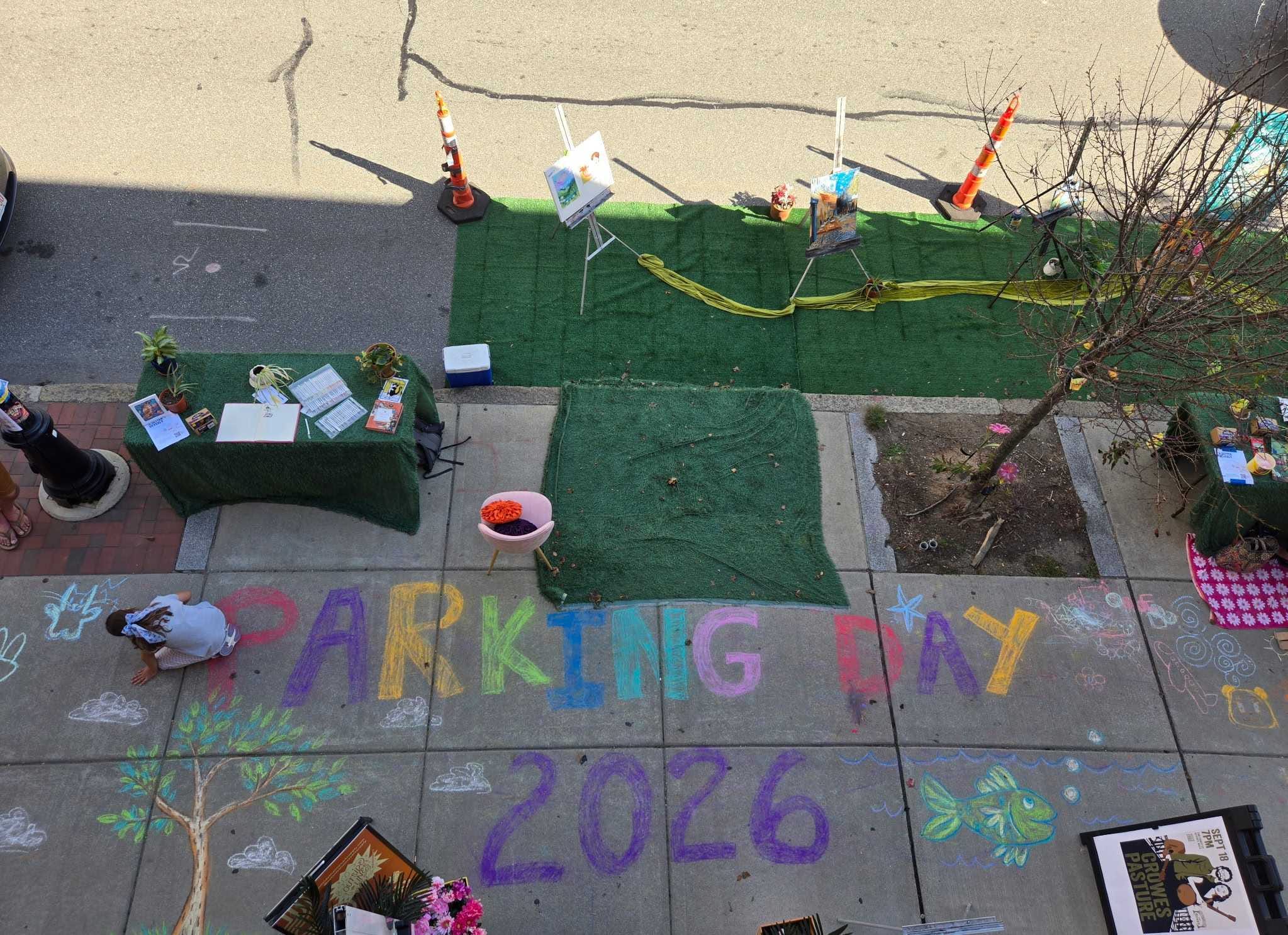
Thinking back to my piece last year, I wanted to create something that I could use to help community members plan for their Park(ing) Day event.
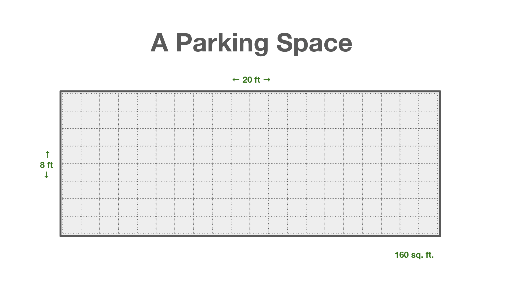
My argument then focused on how much land NYC had, and how an extraordinary amount of that land was dedicated to parking. There are an estimated over 5.4 million parking spaces across the five boroughs. Assuming a standard parking space, typically 8 ft. by 20 ft., this adds up to over 860 million square feet, over 20 Central Parks put together.
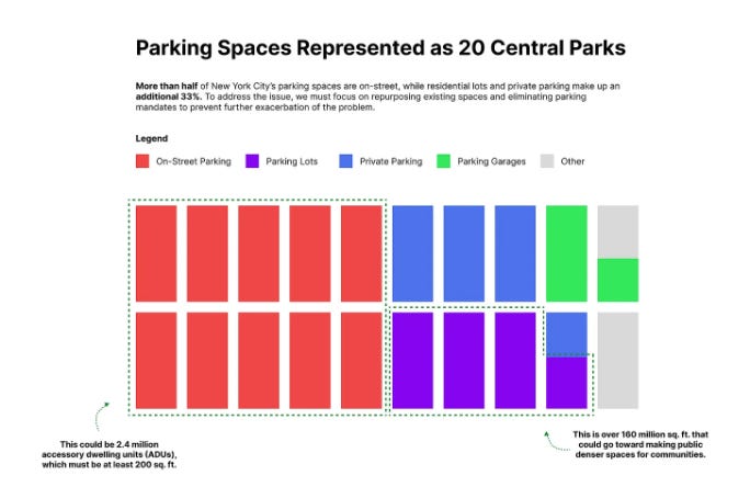
A breakdown from an internal 2016 investigation revealed that the split of these spaces are around 3 million for curbside on-street parking, with surface lots making up around 1 million. I thought a great way to position the argument would instead be to focus on what this space could be used for instead, just like folks do for Park(ing) Day.
“When mandates are lifted, the supply and demand of parking are right sized, and developers and the city can instead use that land for more housing, green space, or any other use.” — Michael Sutherland, Policy Analyst at Open Plans
Up on Figma, I mapped out a simple floor plan, similar to one I created when redesigning my apartment, and laid out two parking spaces that could hold an outdoor dining unit, a bus shelter with a spot.
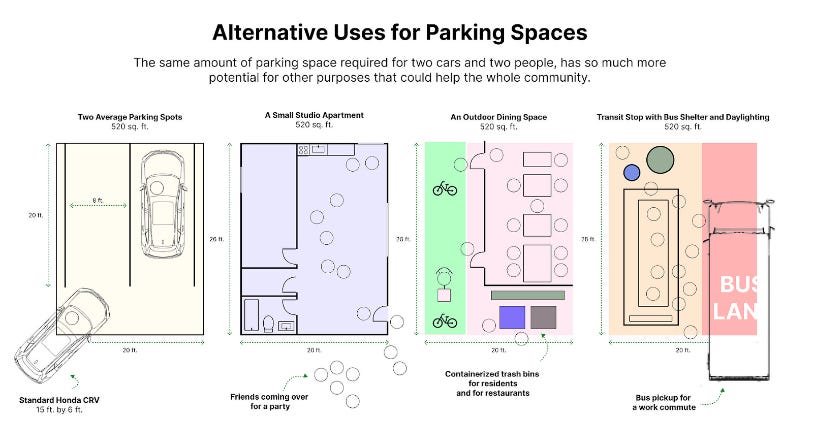
Based on this design, I thought that this year, what I could create would be a tool that could help community members design this space for themselves, in the same way I focused on designing the visual myself.
In this manner, when the city presents proposals for how to design a curbside or a neighborhood block, a community member could also bring up their own design and pitch. We’ve seen this to great success with the recent proposals for Park Avenue, when street-safety advocate Alex Duncan — or better known online as Miser — generated an alternative approach with AI, imagining a version that gave more room to pedestrians and cyclists, instead of a choice between one or the other.


By making this idea visible, folks could actually look at, provide feedback, share and discuss. This made the idea more real and circulated online, giving people another reference point. And it made its way into the actual final decision made for Park Avenue, released just this past week.
There is nothing inherently radical about a resident proposing another option, as this is what community engagement is supposed to enable. But it is quite difficult for someone that is not a transportation consultant or urban designer to know the right way to voice feedback in a way that is constructive and impactful. Even more so for someone to be able to know the right steps to implement their feedback given the lack of transparency between permitting or process.
Community planning tools should make this much easier to understand.
Outside of government, we’ve become quite accustomed to remarkable sophisticated interfaces to help us make spatial decisions. IKEA makes it easy to map out a kitchen to look like in your apartment and Amazon allows you to visualize what a product could look like at home. Headsets are looking to push beyond VR and AR.


Planning tools over the past decade or so have also slowly grown in sophistication. Streetplan and Streetmix make it easy to understand the cross-section of a street. 3D Street does something similar, but as its name suggests, is more focused on a 3D rendering. Floorplanner is focused on interior floor layouts. And Mixity is creating a virtual visualizations for street furniture.
With generative AI, this becomes even easier for someone to do, where anyone could take a photograph of a street and turn it into an alternative version with plain language. The resulting image may be technically inaccurate and violate regulations, but it gets the idea across. The power of this rendering is that someone can visualize what they are thinking.
I wanted to take all of these ideas and create an easy to use interface that could not only help someone visualize what a change could look like, but also help someone bring their idea into implementation, detailing the next steps, the right budgeting, and compare it against other projects so that bringing up this project at a community meeting could actually have legs. There should also be more material for them to help make this idea gain support from across the online landscape.
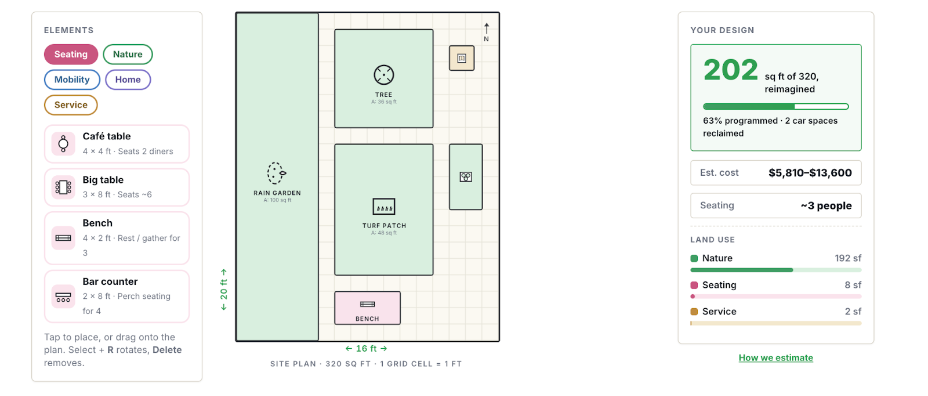
And so I created Parking, Reimagined, an open civic planning platform that helps everyone understand what we trade off when we dedicate public space to parking, using easy-to-understand visuals and cost comparisons.
Visit it at http://parking-reimagined.com/.
This tool can be used by residents, advocates, planners, and consultants alike. With this tool, anyone could ask themself what they want a space to be and reimagine it with elements from the library. Costs and land use zoning is budgeted out, with other examples of parklets that have done it before. If they aren’t sure where to start, there are also templates for someone to start with, so they can be inspired.
The design can then be printed out or uploaded as a PDF to share in a presentation or to a community board so that elected officials can see how they could implement your design.
Inspired by Possible’s Design Your Own Parklet toolkit, I also created a physical print out version of one’s designs, from Parking, Reimagined, so you could bring this same concept to a community board meeting, almost like a game for someone to move elements around on a grid. There is also a way to present this as a workshop presentation.
I’m currently working to add more examples, adding a 3D visual that will be based on the designed floor plan, and researching additional opportunity costs that can be compared against the cost of the designed parklet. I’m also working on additional ways to pair this with other parking management tools, linking it up with budgeting and the permitting process.
I’ve begun talking about piloting this out with community organizations and investigating funding methods that could be paired with housing and transit projects. Because the process differs per city and state, this will require more time and effort.
My hope is to see Parking, Reimagined taking the best part of the tools above, making it a general easy to use open source tool that can be actionable. If you know of folks who work for cities, BIDs, practitioners, and civic organizations willing to help validate costs, different implementation processes, and test out the tool in communities, please reach out!
Big shoutout already to the Parking Reform Network for the initial feedback, especially to Tony Jordan, Jeremy Lawrence, Ann Cheng, and Paula Acero. And to BetaNYC for allowing me to present at the Civic Tech Summer Showcase a few weeks back.


I’d like to share one final inspiration: Spot’s Parking Lot.
Created by Bridget Brown back in 2014, I see this book as one of the best examples about how powerful visuals can be. She goes out of her way to show how much space one car takes, and how it could instead be replaced for the community — dancers, libraries, dining, and so much more.
It’s time for the community to decide how it wants to use its public space. Let’s lift parking mandates and redesign these parking spaces.